Pays de Serres Cluniac Trail – Central loop
Here you will find the maps and the trail guides
Work is in progress ; the trail guides will be available soon.
Here you’ll find the maps published in OpenRunner, so you can pick up the GPS track once you’ve chosen your route. Let’s go !

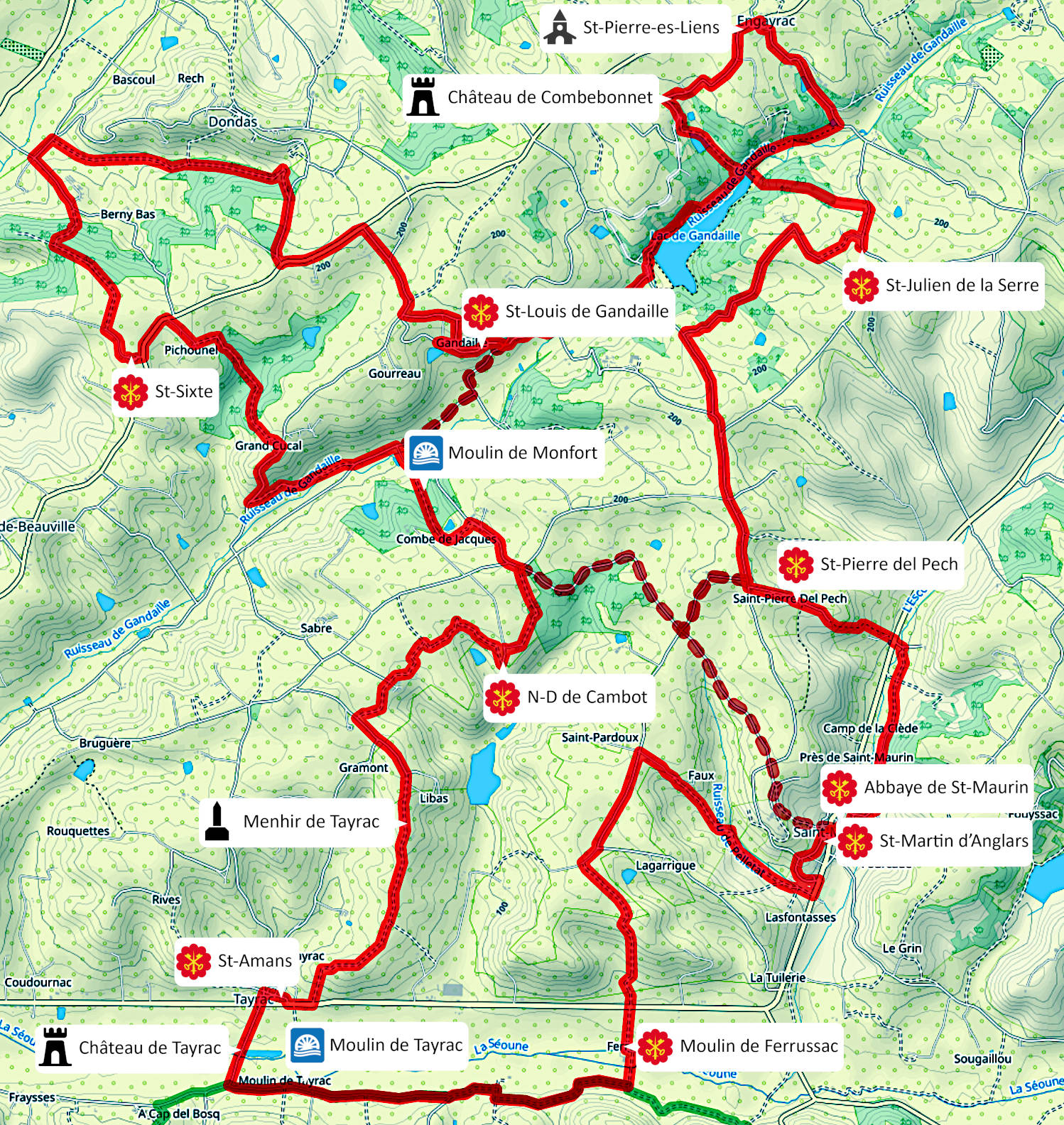
This is the global view of central loop. It is labelled BC0 on the directional signs.
It is 40km long, with an altitude difference of almost +1100m.
You’ll visit the former possessions of Saint-Maurin Abbey: the churches of Saint-Pierre del Pech (Saint-Maurin), Saint-Julien de la Serre (Dondas), Saint-Louis de Gandaille (Dondas), Saint-Sixte (Saint-Marin de Beauville), Notre-Dame de Cambot (Tayrac), Saint-Amans (Tayrac), Saint-Martin d’Anglars (St-Maurin) and the Ferrussac mill (St-Maurin). The remarkable sites of the church of Saint-Pierre-es-Liens (Engayrac) and the château of Combebonnet (Engayrac) are also on the trail.
The central BC0 loop has a suggested variant that links St-Louis de Gandaille to Notre-Dame de Cambot (cutting out St-Sixte); the total distance of this variant is 31km, with an altitude difference of +820m.

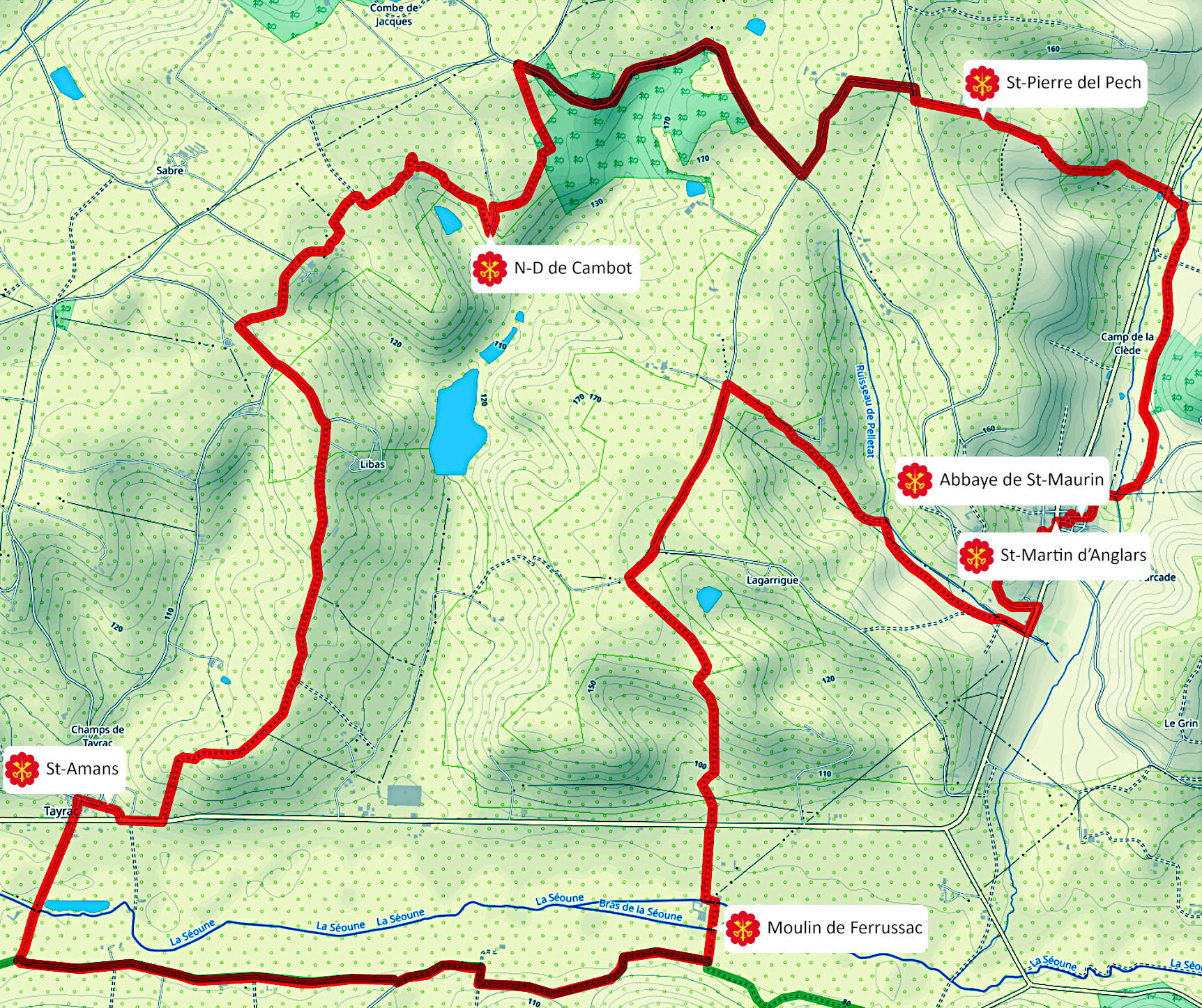
A first sub-loop is proposed, it directly links the church of Saint-Pierre del Pech to Notre-Dame de Cambot. The trail is 19 km long with an altitude difference of +470m. It is labelled BC1 on the directionnal signs.

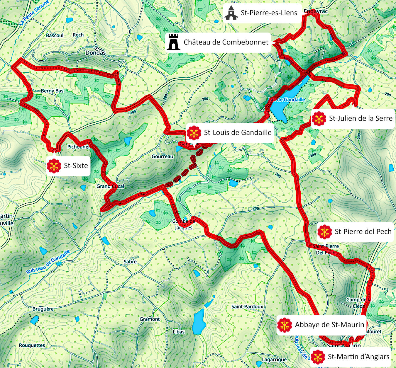
A second sub-loop is proposed, it directly links the church of St Sixte to the Abbey of St Maurin. The trail is 29 km long with an altitude difference of +800m. It is labelled BC2 on the directionnal signs.
