Pays de Serres Cluniac Trail – South loop
Here you will find the maps and the trail guides
Work is in progress ; the trail guides will be available soon.
Here you’ll find the maps published in OpenRunner, so you can pick up the GPS track once you’ve chosen your route. Let’s go !

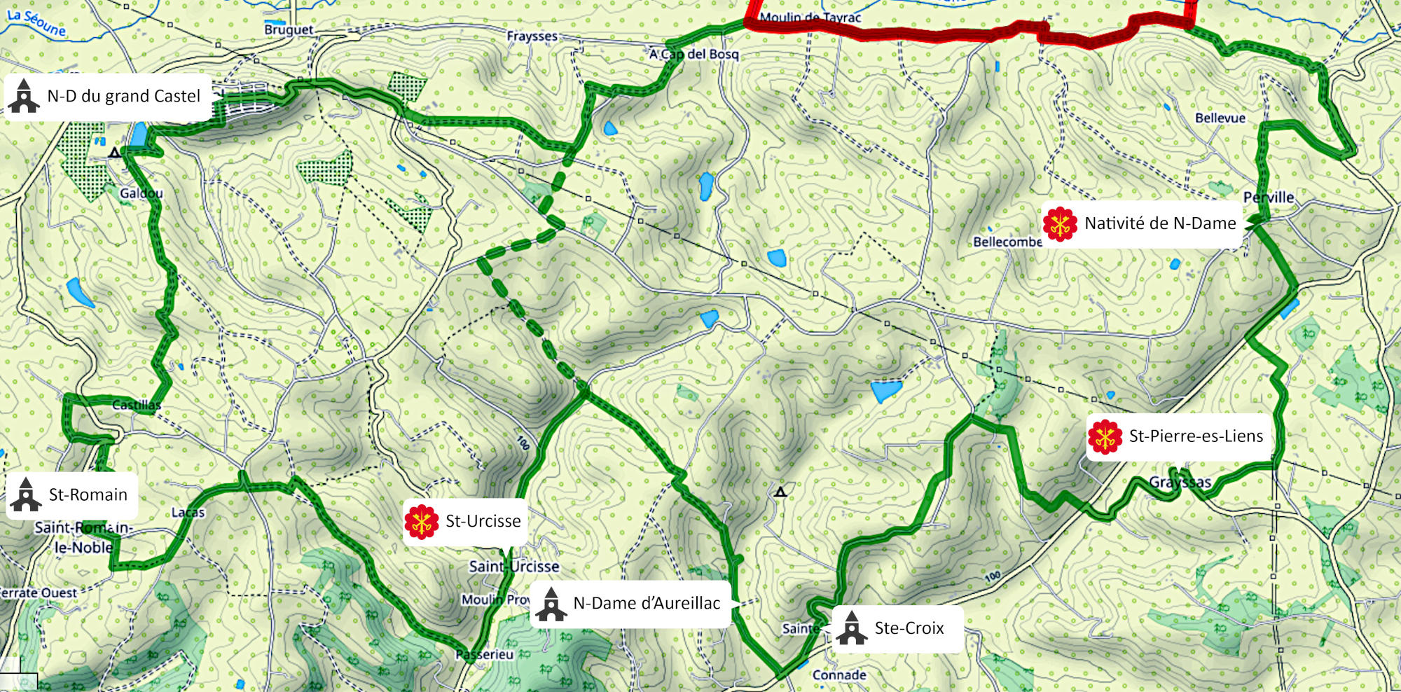
This is the global view of south loop. It is labelled BS0 on the directional signs.
It is 30km long, with an altitude difference of almost +550m.
You’ll visit the former possessions of Saint-Maurin Abbey: the churches of Saint-Pierre-es-Liens (Grayssas), the Nativité de Notre-Dame (Perville) and Saint-Urcisse. The remarkable sites of the churches of Saint-Romain, Notre-Dame d’Aureillac (Saint-Urcisse), Sainte-Croix (Saint-Urcisse) et Notre-Dame du Grand Castel (Puymirol) are also on the trail.

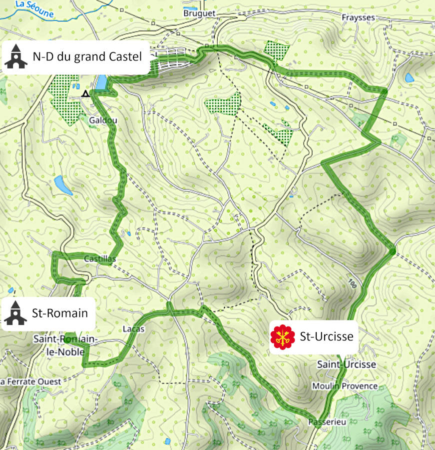
A first sub-loop is proposed, it directly links the church of Notre-Dame du Grand Castel to the church of St Urcisse. The trail is 15 km long with an altitude difference of +260m. It is labelled BS1 on the directionnal signs.

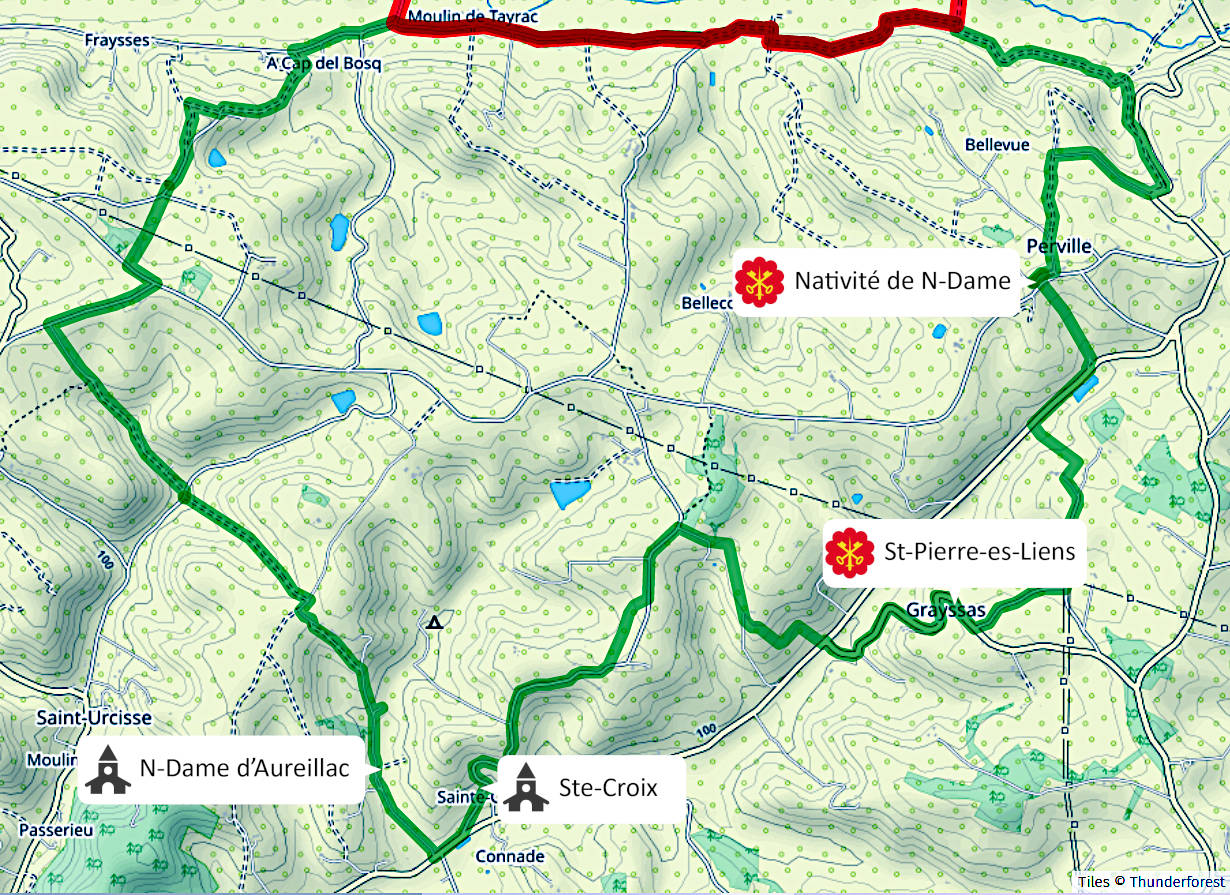
A second sub-loop is proposed, it directly links the church of the Nativité de Notre-Dame to the chapel Notre-Dame d’Aureillac. The trail is 20 km long with an altitude difference of +360m. It is labelled BS2 on the directionnal signs.
